


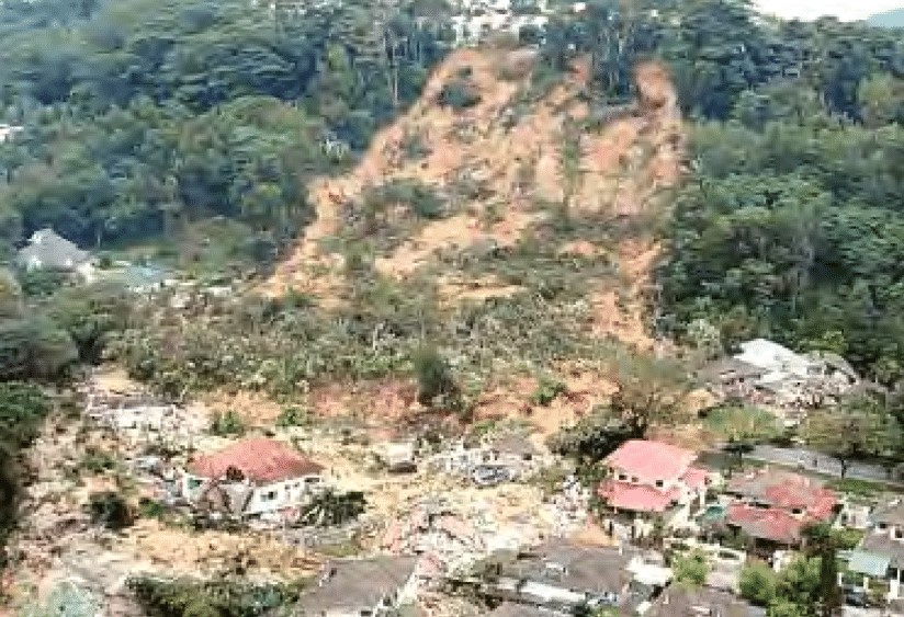
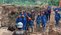
KUALA LUMPUR – The deadly landslide near Gohtong Jaya early morning yesterday could be due to the embankment failure at the road above the Father’s Organic Farm campsite.
Based on several photos of the landslide area and aerial view video captured by a drone operated by the Fire and Rescue Department, an environment and road expert said that overburden on the slope at the campsite could also have contributed to the disaster.
“In this case, I suspect overflow from the embankment area because of clogged drains, or perhaps there was excessive rainfall for a number of days prior to the incident and water overflow on the side of the road,” said former Public Works Department (PWD) director-general Datuk Sri Roslan Md Taha.
Stressing that embankments have different characteristics than a cut slope, he said that a well-maintained embankment at Jalan Batang Kali – Gohtong Jaya was very critical to control the water flow in the area.
He opined that a patrol unit should have maintained the embankment, including removing pieces of wood, dry leaves or debris to ensure the drainage was functioning and there was no ponding.
“Considering that December is the rainy season, there should be a monitoring team assigned by the road owner.
“Once there is ponding or the drain gets clogged up, the overflow is very dangerous, which brings disaster,” he said, adding that the road monitoring unit should also look for tell-tale signs like fallen trees or soil movement.
He asserted that a clogged drain would result in a failed culvert and increase water retention of the soil at the spot where the slope failed.
“The culvert could be choked and didn’t function effectively thus causing water to leak and infiltrate. Once there is water overflowing on embankment slopes, the tendency for landslides to occur will be very high.
“I am quite confident the roadside drain was not maintained, and likely clogged – and because of that, water or the rain overflowed to the embankment,” said Roslan, who has academic backgrounds in civil engineering, civil environmental engineering and environment.
The former Board of Engineers Malaysia president opined that overburden of the slope such as land clearing downstream might have exacerbated the issue.

“Some (land) clearing at the farm could have worsened the landslide, created disturbances downstream, and increased the overburden on the slope, thus causing the landslide.
“Once there are disturbances at the bottom such as vegetation orchards and hillslope clearing, it may cause some add-on effects,” said the PWD thoroughbred with 37 years of experience in the civil service.
“In this case, the overburden from the top would be very heavy and the bottom load or structure of the slope may not be able to keep up with the loose part at the bottom,” he added.
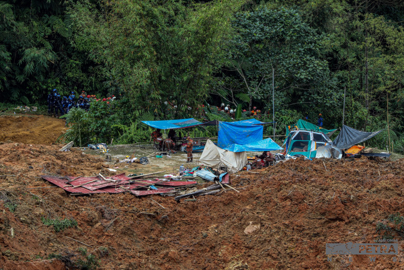
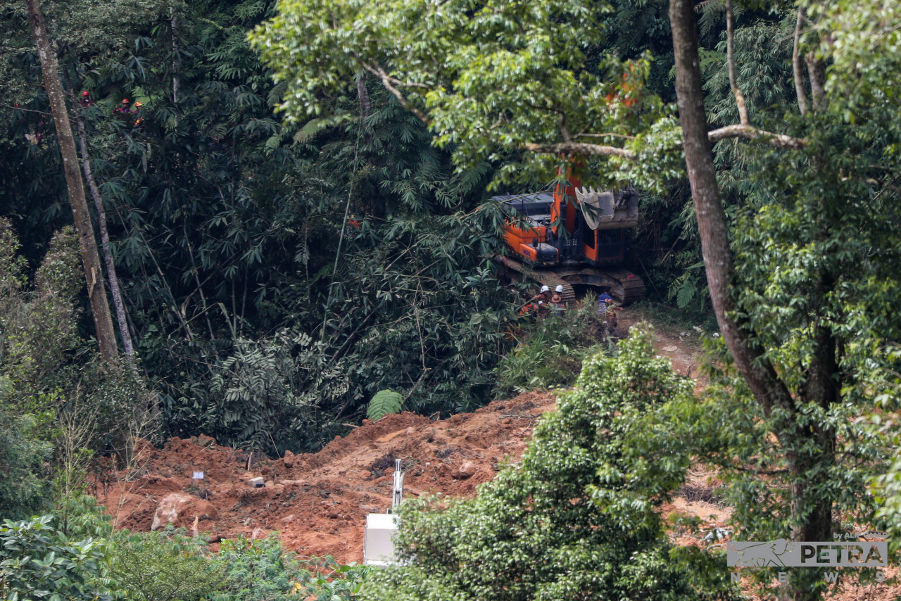
According to the Mineral and Geoscience Department director Hisamuddin Termidi, the landslide area is 500m in length, 200m in width, and about 8m deep.
“The landslide saw a displacement of 450,000 cubic metres,” he said.
When asked if the Gohtong Jaya tragedy has similar characteristics to the 2008 Bukit Antarabangsa landslide, Roslan agreed that there could be similarities.
In the report by a special technical committee submitted to the Selangor government, among the factors attributed to the tragedy 14 years ago were loose soil of the retaining slope during construction, lack of maintenance to the drainage system in the area surrounding the failed slope and constant rain a couple of weeks before the landslide occurred.
Yesterday, Hisamuddin said the fatal landslide was caused by the weakening of hillslopes by underground water flow.
He said that based on the department’s early observations, “homogeneous material” from the top of the higher ground had fallen after the slopes’ base gave way, following contact with water.
Natural Resources, Environment, and Climate Change Minister Nik Nazmi Nik Ahmad after inspecting the location, said that authorities were not ruling out the possibility of more landslides at the Batang Kali campsites. – The Vibes, December 17, 2022


_25022021_-_KUL_-_WAN_SAIFUL_WAN_JAN_INFORMATION_CHIEF_OF_BERSATU_INTERVIEWED_ON_PH_FALL_ANNIVERSARY_-_SADIQ_-_32.jpg)