


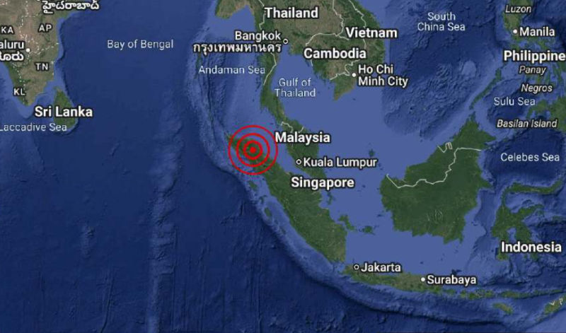
A MODERATE magnitude 5.7 earthquake struck off northern Sumatra at 12.18pm on Wednesday, with tremors felt across several areas along the west coast of Peninsular Malaysia, according to the Malaysian Meteorological Department (METMalaysia).
METMalaysia said the earthquake occurred at coordinates 4.2 degrees North and 97.6 degrees East, at a depth of 10 kilometres. The epicentre was located about 55 kilometres southwest of Langsa, Indonesia.
The department said the tremors were felt in parts of the west coast of Peninsular Malaysia but did not issue any tsunami warning.
Meanwhile, Indonesia's Meteorology, Climatology and Geophysics Agency (BMKG) reported that the earthquake measured magnitude 5.7 and urged residents to remain vigilant for possible aftershocks.
The latest earthquake follows a series of seismic events recorded across Indonesia in recent months.
On Feb 21, BMKG recorded a magnitude 4.7 earthquake in Tangerang Regency, Banten, with its epicentre located on land at a depth of 160 kilometres. No tsunami threat was reported.
A day later, a magnitude 5.0 tectonic earthquake struck off the northern coast of the Mentawai Islands in West Sumatra. Tremors were felt in several parts of the province, although no significant damage was reported.
On Feb 24, a shallow magnitude 3.2 earthquake linked to active fault movement shook parts of Bogor Regency and Sukabumi in West Java. The quake occurred at a depth of six kilometres and caused light tremors in surrounding areas.
Indonesia lies along the Pacific "Ring of Fire", making it one of the world's most seismically active countries, with earthquakes and volcanic eruptions occurring frequently. - July 22, 2026