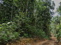


JOHOR BARU – Forest land destroyed on the northeastern coast of Johor, shown on satellite images, may have been part of a forest reserve that has now been degazetted.
Following an environmental impact assessment (EIA) report carried out by Golden Ecosystem Sdn Bhd, which was approved by the Environment Department in May 2017, the land was understood to be part of the Jemaluang Forest Reserve.
The EIA said the reserve was “degazetted and transferred to private ownership under agricultural status”.
Although the EIA does not state when the forest was degazetted, Macaranga.org said the Jemaluang jungle was gazetted as a reserve in October 1923.
However, Macaranga reported that the land was not listed in the Johor Forestry Department’s reports from 2015 to 2019, suggesting that the exercise occurred in 2014.
The Vibes is awaiting a response from the Johor Forestry Department concerning the degazettement date of the Jemaluang forest.
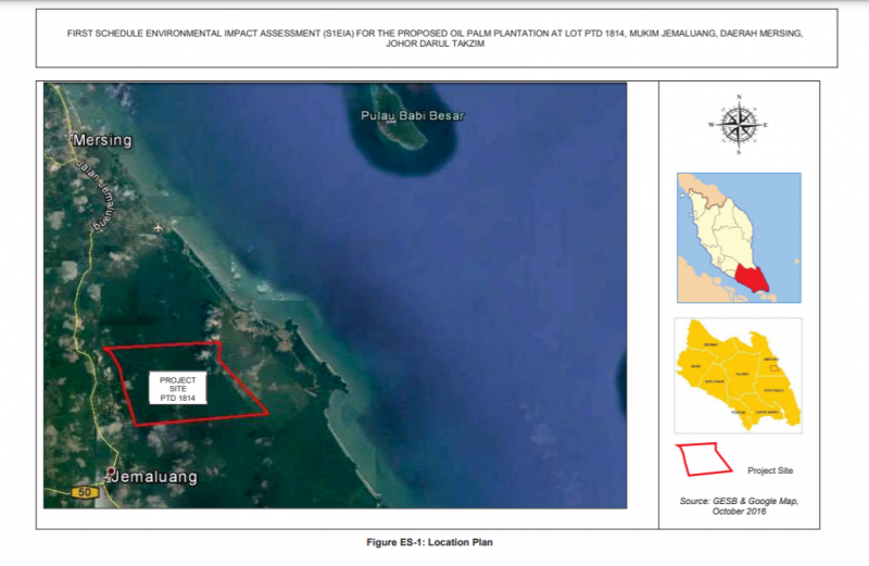
Additionally, the EIA report stated that 2,190ha of the forest was proposed for the “development of oil palm plantations”.
The company listed in the EIA as the proponent for the oil palm development project is AA Sawit Sdn Bhd.
Checks on the Malaysian Companies Commission (SSM) website revealed that AA Sawit was created in 2008 with RM5 million issued shares, and has Johor Crown Prince Tunku Ismail Sultan Ibrahim as the director and Sultan of Johor Sultan Ibrahim Sultan Iskandar as the majority shareholder.
The EIA said the 2,190ha was selected based on the economic need to convert “unproductive land” by planting oil palm trees, which can generate revenue for the state.
However, it was also stated that 71 mammal species are “present or expected to be present” in the project area, six of which are elephants, tapirs, bears, pigs, leopards, and deer.
Also, the project area was stated to be a habitat for the spiny hill turtle and the asian giant tortoise.
The EIA did take into account the potential impact the project will have on fauna in the area, emphasising habitat loss.
The mitigation measures proposed included consulting with the Wildlife and Natural Parks Department, along with the relocation of fauna to the nearest forest.
Most impacts can be prevented or minimised by careful planning during the various stages of development.
“With the incorporation of appropriate design, sound implementation methods and mitigation measures, the proposed project by AA Sawit can be implemented in an environmentally acceptable manner,” the EIA’s conclusion read.
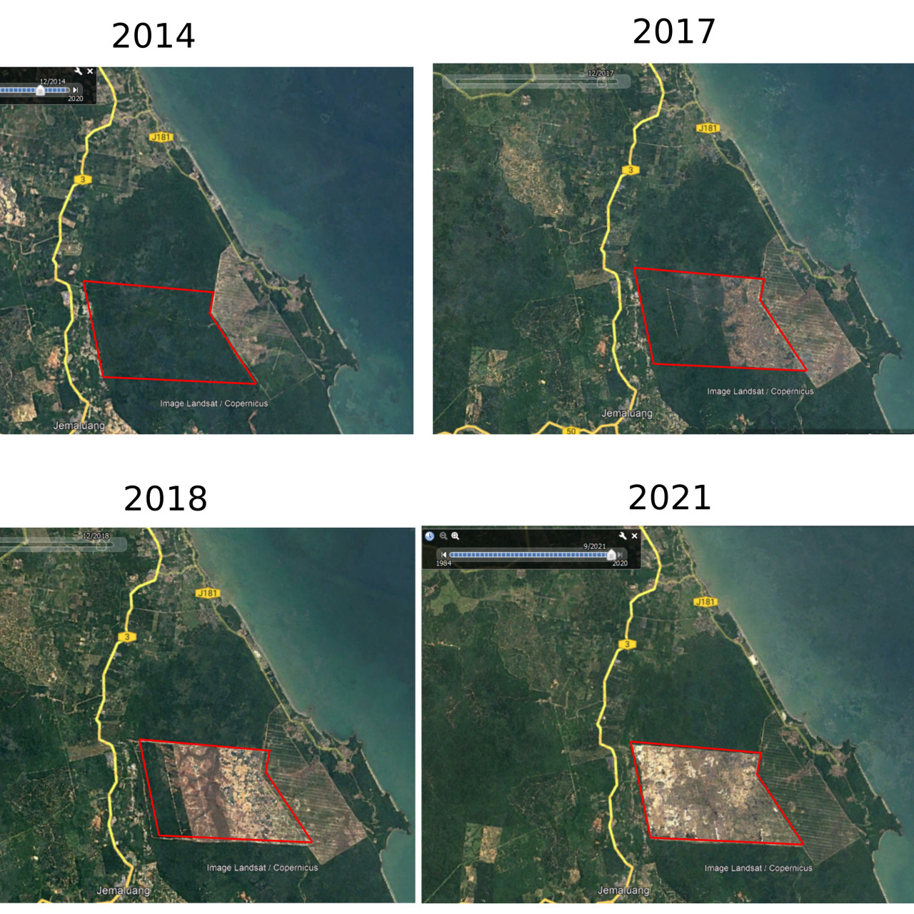
The Vibes also sighted historical satellite data on Google Earth showing that the area concerned in 2014 filled with forest.
Based on satellite images, the clearing of the forest began sometime between 2016 and 2017.
The latest satellite imagery by Google Earth shows the forest area now clear. – The Vibes, September 29, 2021