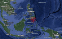


KOTA KINABALU – Despite the recurrence of earthquakes in Sabah, the government lacks the resources to mitigate risks even after the deadly Ranau quake in 2015, said geologist Felix Tongkul.
In a speech carried live online, he said 67 quakes have been recorded in the state from the 1900s to 2019, with the four major ones taking place in Ranau, Darvel Bay in Lahad Datu, and Kudat.
“Over the course of 100 years, Sabah has recorded four quakes with a magnitude of 6 and higher – Kudat in 1951, Lahad Datu in 1923 and again in 1976, and Ranau in 2015.”
Although the data comes up short on recurrence intervals, based on existing records, quakes are expected to hit Ranau every 24 years, and Lahad Datu every 53 years.
“Based on this, we expect another major quake in Lahad Datu soon,” said Tongkul.
He said there were no proper monitoring systems in place until after the Ranau quake in June 2015 that killed 18 people.
He said 28 seismic stations have been built since, but there are still blind spots in Lahad Datu and Kunak.
Quakes are unpreventable, he said, but the study of past incidences, coupled with monitoring, can minimise the related risks.
“Accurate quake prediction is still not possible. But, many aspects of quake behaviour can be anticipated with enough precision to mitigate risks.
“But sadly, the science on quakes in Malaysia is still in its infancy, and only came up in 2017.”
A study conducted in the aftermath of the incident in Ranau showed that quakes are felt in both East and West Malaysia due to shifts in the Eurasian-Sunda, Pacific-Philippine and Indian-Australian plates, he said.
He said the Eurasian-Sunda plate moves about 4cm each year, Pacific-Philippine plate (10cm) and Indian-Australian plate (7cm).
As a result, seismic activity has been recorded in Bukit Tinggi, Kuala Pilah, Manjung, Temenggor and Kangar in the peninsula, but they are mostly from the Sumatra and Andaman Islands, with a magnitude of not more than 4.
For Sarawak, most seismic activity is generated locally, with a magnitude of less than 5, in Samarahan, Bekenuh, Niah and Kuching.
The Survey and Mapping Department has installed some 20 global satellite monitoring systems, but these are not enough as they do not provide high-resolution images, which are crucial for research purposes.
Tongkul said few students study geology and quake engineering at university, adding that the National Seismic Building Code in 2017 is not gazetted as law. – The Vibes, November 18, 2020