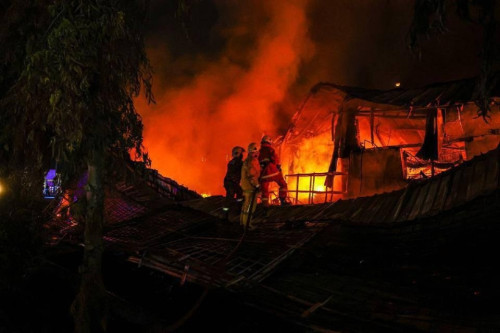


MIRI – The threat of wildfires in Borneo should no longer be taken lightly by the authorities and public as new satellite images show numerous intense hotspots across the southern expanse of the large island, with several of them raging in Sarawak.
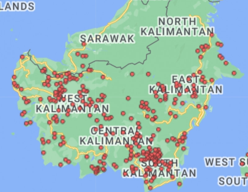
The latest images from space recorded by the Asean Specialised Meteorological Centre (ASMC) show Sarawak having about a dozen large-scale blazes with red and orange shades, signifying their intensity.
The neighbouring Indonesian province of Kalimantan seems to be hit even worse with almost countless hotspots across its vast expanse. Some of these are very near the Malaysian boundary line.
Of additional concern for the Malaysian side is that the images also show winds blowing in the northward direction, from blaze-stricken Kalimantan towards Sarawak.
The Asean Specialised Meteorological Centre based in Singapore is a regional centre for monitoring transboundary haze and forest fires in all Southeast Asian countries.
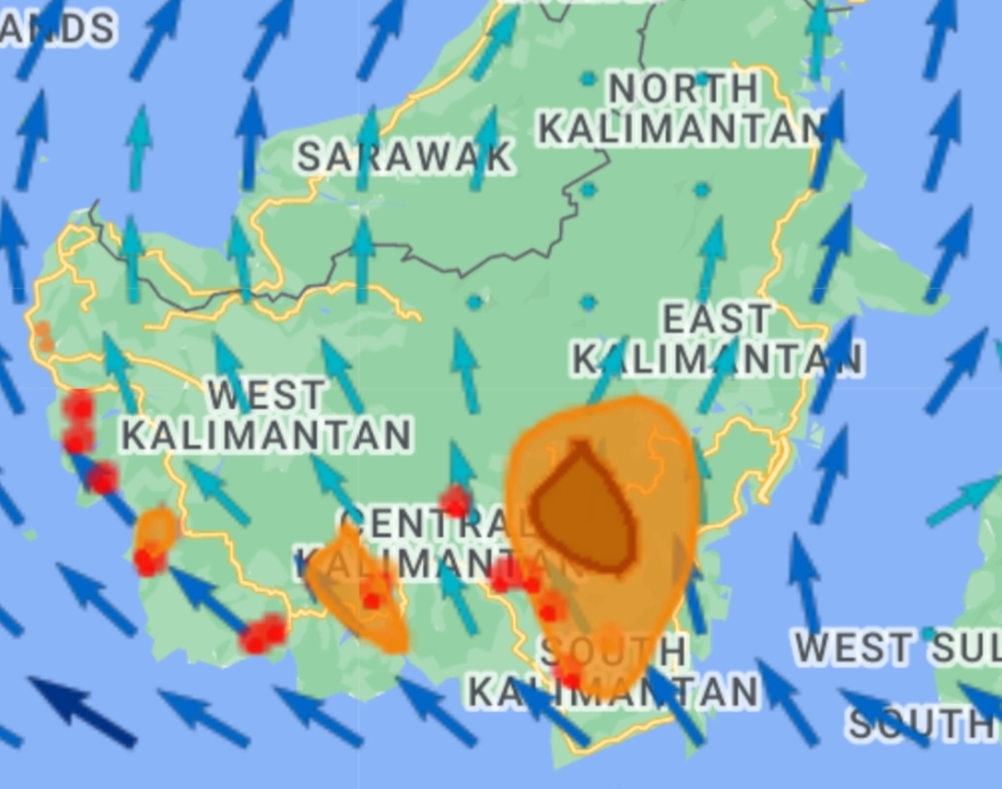
A red hotspot on a satellite image means that the wildfire is at least one acre in size (roughly the size of a football field) while an orange dot represents a fire less than an acre in size.
A check by The Vibes on the latest ASMC images point to Kalimantan being the biggest source of wildfires now on Borneo Island and in the Southeast Asian region.
There are several red hotspots in the southwestern side of Sarawak along the border with Kalimantan.
The red and orange hotspots in Kalimantan cover almost the whole of the western and southwestern sides of that territory.
The information on the ASMC website corroborates that the western and southwestern parts of Kalimantan are seeing the most hotspots, while there are a few in Sarawak.
The southern Sarawak districts that are already hit by fires and those that seem dangerously close to blazes near the Indonesian boundary line include Lundu, Bau, Serian, Samarahan, Semenggang and Lubok Antu.
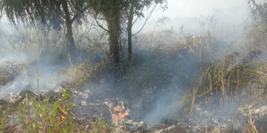
All these districts have vast areas of equatorial rainforests that are vulnerable to rapidly spreading large-scale blazes. Many of these areas are highly difficult to access on land.
Districts nearer to central Sarawak that are either already having fires or at risk include Sibu, Sarikei and Julau.
Precautionary enforcement
The ASMC also said the latest weather over Borneo is largely dry and cloudy. This points to the likelihood that the fires may not abate anytime soon.
Sarawak has already imposed a ban on all forms of open burning of agricultural and domestic wastes, following escalating cases of forest fires and increasing air pollution in numerous parts of this vast state.
The Sarawak Energy and Environment Conservation Ministry has directed the state Natural Resources and Environment Board (NREB) to enforce the ban while coordinating with the federal Environment Department.
Its minister Hazland Abang Hipni said the NREB was sending out notices to all quarters and stakeholders to comply with the ban. Offenders can be jailed for a maximum of five years and fined RM100,000 or both if convicted.
The public has also been told to wear masks and reduce outdoor activities in places affected by air pollutants.
The past few weeks have seen air pollution soaring as the number of forest fires escalate in Kuching, Sarikei and Mukah in central Sarawak, and Miri in the north.
Borneo is not the only island suffering in this global wildfire phenomenon that is believed to be caused by climate change.
According to reports, there have been many human lives lost, with properties and natural environments severely damaged, in Europe and the Pacific islands, including the Hawaiian island of Maui. – The Vibes, September 4, 2023


.jpeg)