


KUALA LUMPUR – To facilitate travel planning and for the latest on the flood situation during this monsoon season, the public is encouraged to download the MyPublicInfoBanjir application on their smartphones.
Environment and Water Ministry secretary-general Datuk Seri Zaini Ujang said the application displays relevant data such as current river water levels and accurate information on floods in 1,500 areas nationwide through the placement of hydrological telemetry stations.
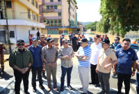
“This application provides highly specific data. If you want to ‘balik kampung’, you can find out if there are floods and such along your journey,” he said after visiting the National Flood Forecasting and Warning Centre here today.
Zaini said more hydrological telemetry stations are expected to be added in the future so that access to flood data in more localities, especially in rural areas, can be obtained.
MyPublicInfoBanjir, which was launched on November 12, was developed for the use of all smartphone users so that notifications on current rainfall, river water levels and flood warning announcements can be accessed in real time.
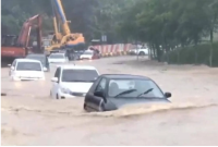
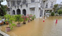
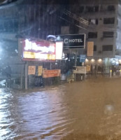
The warning centre has recorded a total of 232 flood incidents from November last year to January 3 this year. – Bernama, January 5, 2021