


SG PETANI – The government will set up a warning system on three conjoined hills that make up Gunung Jerai to alert residents at the foothills to prepare against any landslide or gushing floodwaters in the future.
Energy and Natural Resources Minister Datuk Seri Takiyuddin Hassan said the system will also sound the alarm for the authorities to take immediate action if any natural calamity were to take place.
“The warning system will be set on water catchment areas on Gunung Jerai and will operate similar to a water gauge system,” he said.
“We don’t want a similar incident (as the floods last month) to recur as it claimed six lives and damaged many properties, while also affecting the peace of mind of the residents,” he added.
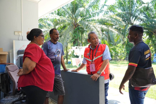
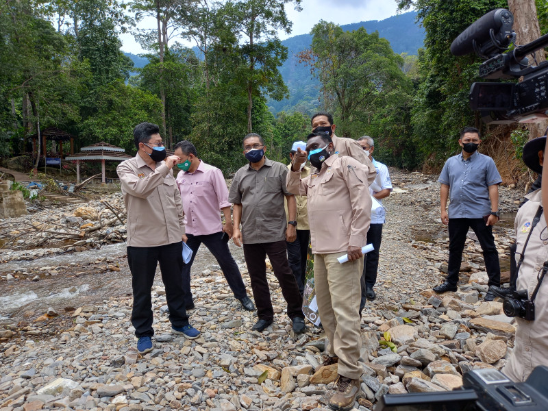
Takiyuddin said this after a working visit to the Titi Hayun Geopark in Yan near here earlier today.
The disaster on August 18 that hit Yan and Kuala Muda, both near Gunung Jerai, led to the areas being declared “emergency zones” by the government.
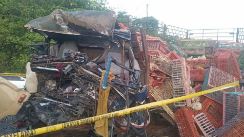
Massive gushes of water and sliding earth from the mountain were accompanied by flooding in areas near the foothills, affecting thousands of homes. The incident also left six people dead.
By August 26, at least 47 more landslides were detected at several locations on the slopes and peak of Gunung Jerai by the Mineral and Geoscience Department’s Geological Disaster Task Force.
Then, last Thursday, already traumatised residents panicked again as heavy rainfall for more than two hours at Titi Hayun and the Seri Perigi waterfall in Yan caused flash floods near Gunung Jerai.
During his visit to the affected areas on August 23, Prime Minister Datuk Seri Ismail Sabri Yaakob had announced a RM75 million allocation to Kedah for infrastructure repairs and RM3 million to the Rural Development Ministry to help residents repair damaged homes.
Takiyuddin said the installation of the warning system and repair works should be completed by November, and expressed hope that the local tourism sector will be restored by year-end.
He noted that Gunung Jeral is one of two Unesco-listed geoparks in the country, the other being Langkawi.
He said departments under his ministry, such as the Mineral and Geoscience Department, Public Works Department, Department of Environment (DoE), Foresty Department and the Fire and Rescue Department, have all gathered information to prevent future calamities in case the phenomenon recurs.
“I will take the findings to the cabinet to initiate an action plan to prevent a similar disaster in the future.
“All the departments are working together in an integrated manner to find the best solution for the problem,” he said.
Takiyuddin said that, based on the findings, the government can also plan to prevent similar incidents elsewhere in the future.
With him during the visit was Jerai MP Sabri Azit and Yan district officer Tunku Iskandar Shah Tunku Muzaffar Shah.
Mineral and Geoscience Director-General Abdullah Sulaiman, who was also present, briefed them on the geological effect of landslides and massive rainfall in the area.
He said that more than 50% of the federal government’s allocation is to be used by the DoE for prevention and rehabilitation.
The catchment area on Gunung Jerai is also important to the Kedah Water Supply Commission for supplies in Yan, Gurun, Singkir, Merbok and Semeling. – The Vibes, September 4, 2021